Travel guide
Reading Ly Son’s volcanic landscape through shore and crater
Ly Son’s scenery becomes more interesting when its landforms are read together. The island offers volcanic rock, cliff sections and crater-shaped high ground, then shows how waves and people have altered that setting. This is an opportunity to observe an ancient landscape; it is not a tour of an erupting volcano.
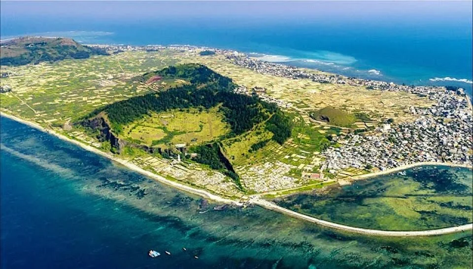
Aerial view of volcanic terrain and settlements on Lý Sơn ·
Thuy-van.Kieu — Ve-dep-dao-ly-son-nhin-tu-tren-cao-1.jpg · CC BY-SA 4.0 · Resized and converted to WebP

Compare shapes rather than memorize numbers
At To Vo, look at the arch against the sea; at Hang Cau, observe the cliff and overhang from a safe distance. The two coastal scenes invite comparison, but they should not be described as identical formations. Exact ages, heights and counts vary between summaries. Understanding the contrast in shape is more useful than repeating an unsupported precise figure.
Add a view from higher ground
Thoi Loi and the Gieng Tien area help reveal the relationship between higher volcanic land and the surrounding island. Use permitted viewpoints and existing approaches rather than tracing an unmarked rim. A broad view can show cultivated plots, houses and coast within one frame. The reservoir at Thoi Loi adds a water-use story, without being a swimming stop.
Distinguish geology from the whole coastline
Waves, weathering and human use continue to shape what you see, so avoid calling every pale or dark layer lava without interpretation. If a guide explains a particular surface, ask what evidence supports the explanation. Volcanic scenery alone does not establish a UNESCO designation. A useful visit can be curious and accurate without attaching a superlative or institutional label.
Keep the outdoor classroom intact
Photograph textures from stable ground and leave rock, shells and reef material in place. Do not chip samples, draw on stone or enter fields for a closer look. Group the eastern sites separately from western To Vo and Gieng Tien instead of crossing the island repeatedly. If wind or waves close one viewpoint, another permitted landscape or a village break can keep the day worthwhile.
Ask VietnamGuide AI
Ask VietnamGuide AISources
Explore more
- Mu Cu Islet: rocky coast and a conditional sunrise plan
Plan a Mu Cu visit around permitted coastal access, stable footing and transport, without assuming night access or lighthouse entry.
- Snorkeling at Lý Sơn: decide before entering the water
Choose a snorkeling provider by sea conditions, supervision, equipment and your ability, with practical ways to protect the reef.
- Chua Duc and Gieng Tien: a measured western island visit
Choose how far to climb around Chua Duc and Gieng Tien, respect worship and combine the visit sensibly with To Vo.