Travel guide
Thi Nai Bridge: see how Quy Nhon connects with the peninsula
Thi Nai Bridge is more than a line on a transfer map: it helps explain how Quy Nhon relates to the lagoon and Phuong Mai peninsula. The view changes as city buildings give way to open water and the land beyond. Treat the crossing itself as a moving part of the journey, then choose a separate, lawful place on shore if you want time to look. There is no need to stop on the bridge to appreciate its place in the landscape.
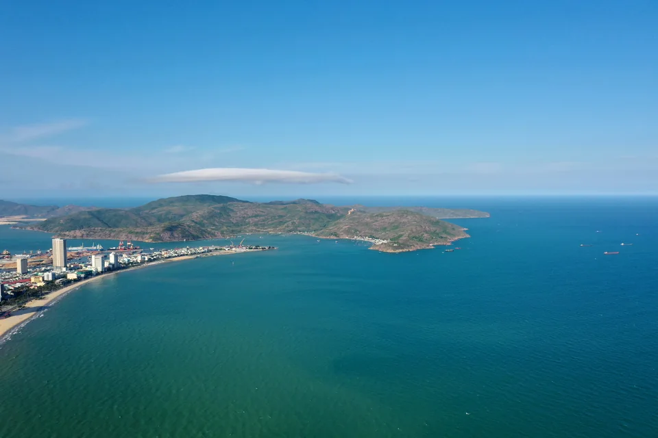
Coastal landscape — Hải Giang, Quy Nhơn. Regional context photograph from Quy Nhon–Binh Dinh. ·
Khachoangmmo · CC BY-SA 4.0 · Resized and converted to WebP

Understand what the bridge connects
The national tourism database places Thi Nai Bridge within the road connection between Quy Nhon and Nhon Hoi, alongside its account of the lagoon and Phuong Mai. Looking at a map before travelling helps you recognise that relationship on the ground. The open sea and the lagoon are different bodies of water in the peninsula setting. Instead of collecting a claim about the bridge being the longest, focus on its practical role: a sequence of spans carrying daily travel across a broad watery gap.
Let the crossing remain a crossing
Enjoy the changing panorama as a passenger while your driver concentrates on traffic. The perspective is brief, so look for a few clear elements: repeated spans, water between the supports and the changing outline of the peninsula. Keep belongings inside the vehicle and do not ask for a sudden stop. Do not plan a walk or a photography session on the roadway or shoulder. A continuous transfer can still be memorable, particularly when you already know which side of the lagoon your next destination occupies.
Choose a shore composition instead
For a longer look, ask your driver or host to identify a lawful, currently accessible shore viewpoint with an appropriate place to park away from moving traffic. Confirm permission rather than assuming an empty patch of land is public. From there, try a wide view in which the bridge becomes one line among water, land and sky. A closer frame can emphasise the rhythm of the spans. Let actual cloud, haze and water conditions decide the image; sunset colour is a possibility, not a guaranteed feature of the visit.
Use one stop to enrich a peninsula day
A bridge-view stop works best as a small addition to a Phuong Mai or Nhon Ly journey, not a schedule built around waiting on a road. Agree on the exact stopping and pickup locations before departure and leave a little time for the return. If no lawful viewpoint is available, keep travelling and enjoy the crossing from your seat. Bring drinking water and avoid interfering with fishing areas or private premises near the shore. The useful takeaway is a clearer picture of the city, lagoon and peninsula as connected places.
Ask VietnamGuide AI
Ask VietnamGuide AISources
- 1. csdl.vietnamtourism.gov.vn/dest/
Source checked:
Explore more
- Ky Co Beach: give the coast time to reveal its colours
Discover Ky Co as a beach of pale sand and mountain edges, with a relaxed shore visit and a realistic choice between boat and road arrangements.
- Eo Gio: follow the wind and the curve of the rocks
Explore Eo Gio as a rocky coastal viewpoint, with a measured walk on open paths and time to watch the meeting of mountains and waves.
- Hon Kho: choose an island day from Nhon Hai
Plan a thoughtful Hon Kho boat outing from Nhon Hai, balancing the rocky island scenery, optional water activities and a clear return arrangement.