Travel guide
Map Lý Sơn by area: east, west and the ferry port
A useful Lý Sơn map should help you choose a route, not encourage you to collect every landmark. Start by marking your accommodation and Bến Đình, then group nearby places. The biggest planning improvement is usually fewer crossings of Đảo Lớn and a clear distinction between ordinary roads and exposed coastal terrain.
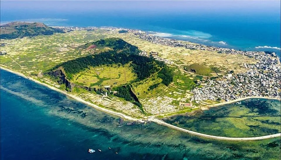
Aerial view of volcanic terrain and settlements on Lý Sơn — Illustrative Ly Son setting; not a verified photograph of the specific place, dish, room or service discussed. ·
Thuy-van.Kieu — Ve-dep-dao-ly-son-nhin-tu-tren-cao-1.jpg · CC BY-SA 4.0 · Resized and converted to WebP

An eastern outing around Thới Lới
Thới Lới, Hang Câu and Chùa Hang belong in the same eastern planning group, although their approaches and walking conditions differ. Choose the places that suit your group rather than treating the group as a compulsory walking circuit. A viewpoint, a coastal overhang and a place of worship each need different footwear, time and behaviour.
A western outing around Tò Vò
Tò Vò, Chùa Đục and the Giếng Tiền area form a useful western cluster. Decide whether your outing is mainly a gentle coastal visit or includes uphill steps. Leave room to rest before a sunset stop, and arrange a return ride if walking after dark would make the route uncomfortable.
Keep ports as separate map pins
Bến Đình is the mainland ferry terminal on Lý Sơn; it is not a substitute for confirming the meeting point of an Đảo Bé boat. Save the precise pier, operator contact and accommodation pickup point offline. On your departure day, build the route around check-in and baggage instead of squeezing in a distant attraction.
Read the ground as well as the map
A line near the coast does not establish a safe public footpath. Use recognised roads and permitted approaches, ask about barriers and steps, and turn back from wet rocks or cliff edges. Garlic fields are working land: stay on agreed paths and ask before entering. A shorter route with a known way home is the more useful map.
Ask VietnamGuide AI
Ask VietnamGuide AISources
Explore more
- When to visit Lý Sơn: choose for the sea and your priorities
Use seasonal context, marine forecasts and flexible connections to choose a Lý Sơn travel window without assuming calm seas.
- Lý Sơn in the rainy season: deciding when to change plans
Build a go-or-change decision around marine warnings, ferry confirmation and practical mainland alternatives.
- Lý Sơn ferry cancelled: protect the rest of your journey
A practical sequence for confirming the disruption, changing connections and documenting refund or rebooking requests.